Observation site
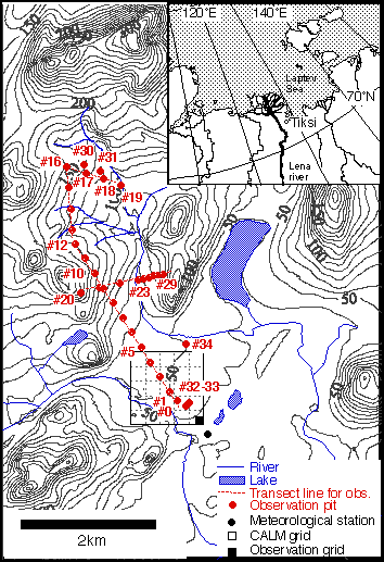
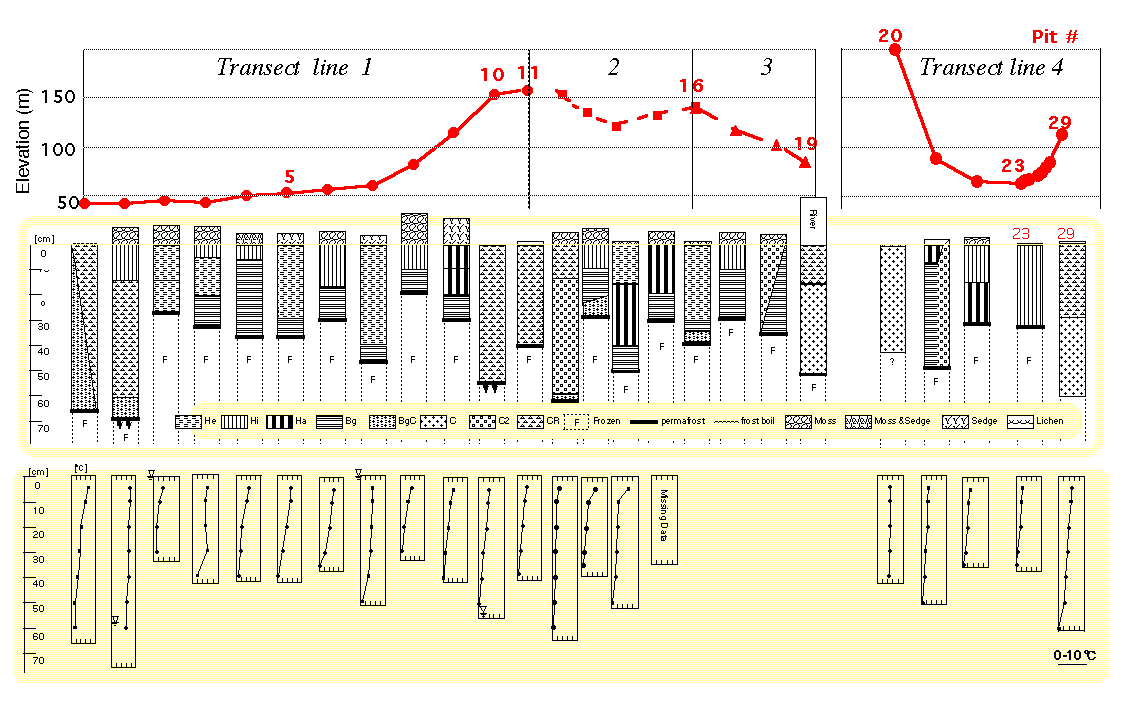
Soil survey was carried out in tundra near Tiksi from 1997 to 2000. Figs 1 and Fig. 2 shows location of Tiksi and observation sites in surveyed area, respectively. Series of soil moisture content and temperature at 5-cm detpth were measured on the transect lines (4 red lines in Fig. 2) with 25-m intervals.
About 40 sites were selected along the transect lines and dug with size of 50 cm x 50 cm on the frozen ground (observation pits). There were tweny four pits (#0 - #23 in Fig. 2) with 250-m intervals and six pits (#23 - #29 in Fig. 2) with 50-m intervals on the transect lines. The active layer soil in the surveyed area were classified into five types based on soil water regime and vegetation (Watanabe et al., 2000). Some pits (#33 - #34 in Fig. 2) were also selected at a place where typical soil types was found (where ground surface was covered with typical vegetation).
Photograh at the pit
At each pit, surface condition, thickness and horizons of the activelayer were directly observed. Photographs of the observation pits are listed in PhotoList. The photograph for #22 is missing. Most observations were performed in rain or cloudy day. The ground water level in the wetland was close to ground surface level. Therefore, some pits (#3-4, #6-8, #16-18 and #25.5) were difficlult to be taken photograp. There were fully water-logged (+ 5 cm or more) or inundating.
In PhotoList, photoguraps about following information were also listed.